





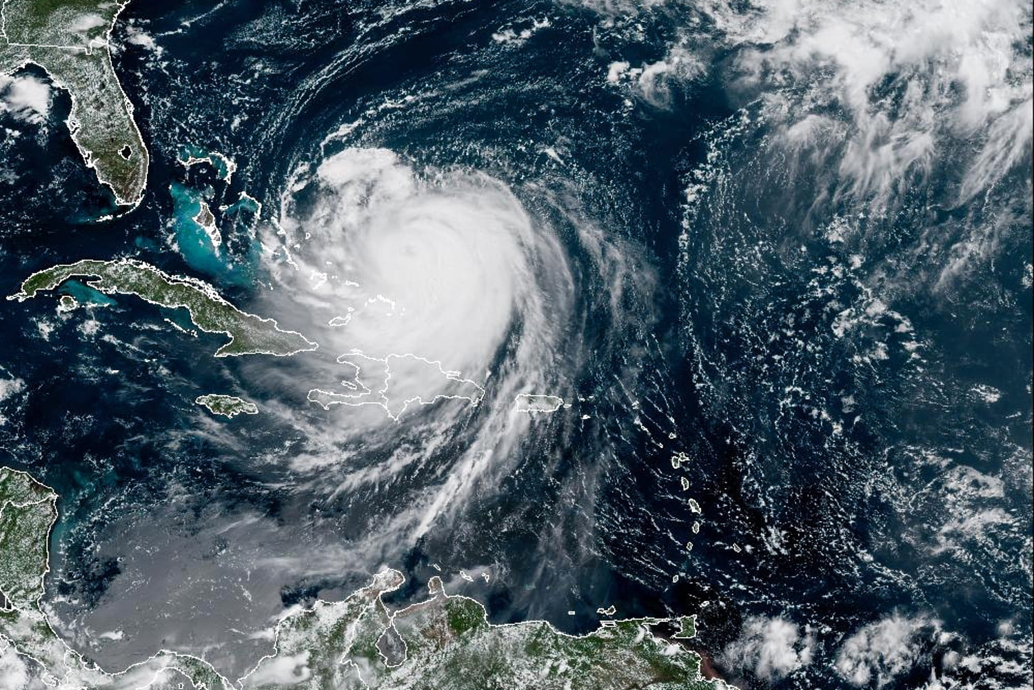
Rapid intensification describes an increase in sustained wind speeds of at least 35 mph over a 24-hour period, according to the National Hurricane Center.
Erin’s maximum sustained wind speed increased around 75 mph in 24 hours, from Friday morning into Saturday.
Climate change is increasing the risk of rapidly intensifying storms, primarily due to warmer-than-usual sea surface temperatures and high levels of moisture in the atmosphere — key ingredients needed for storms to gather strength.
In a preliminary analysis, the nonprofit research organization Climate Central said that Erin’s “extreme rapid intensification” on Saturday occurred as the storm moved over “unusually warm ocean waters that were made up to 100 times more likely by human-caused climate change.”
Erin’s journey near the Bahamas on Monday will keep the storm over warm waters hovering in the mid-80 degree Fahrenheit range, which could help it intensify further. A warmer atmosphere as a result of global warming also holds more moisture, which enables storms to gather strength and dump more rainfall over land.
A 2023 study published in the journal Scientific Reports found that tropical cyclones in the Atlantic Ocean were around 29% more likely to undergo rapid intensification from 2001 to 2020, compared to 1971 to 1990.
Indeed, rapid intensification has been well documented in recent years. In 2019, Hurricane Dorian’s peak winds increased from 150 mph to 185 mph in nine hours. Hurricane Ian in 2022 underwent two rounds of rapid intensification before it made landfall in Florida.
Last year, Hurricane Milton’s maximum sustained wind speed increased by an astonishing 90 mph in roughly 25 hours. Other recent examples of rapid intensification include Hurricane Harvey in 2017, Hurricane Laura in 2020, Hurricane Ida in 2021 and Hurricane Idalia in 2023.
Still, the process of rapid intensification remains difficult to forecast. Scientists know that warm sea surface temperatures, moist air and favorable atmospheric conditions are necessary pieces of the puzzle, but understanding how it will happen for specific storms — and when — will require more research.
In the coming days, the National Hurricane Center said Erin will move between Bermuda and the east coast of the United States.
Though the storm is not expected to make a direct hit with land, the hurricane will generate swells, life-threatening surf and rip currents for the Bahamas, Bermuda, the eastern seaboard of the U.S. and Atlantic Canada.

